Silver Challenge Walk 6
Cow Green & Cauldron Snout
Cow Green & Cauldron Snout

Save the file to your device and then rename it by taking out the .txt at its end. Your device will now open it as a gpx file
|
Distance - 7.5 miles
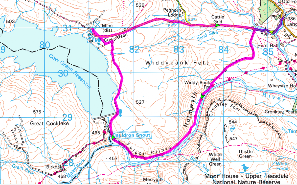
Map : OS Explorer OL31 Parking : Car Park at Cow Green Reservoir (811 309) |
| ||
LANDRANGER 92 O/S Crown copyright 2016 CS-30288-W3Z2M1
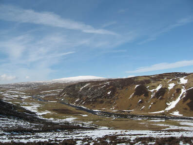
The instructions for this walk are written based upon parking at Cow Green Reservoir, but if you prefer there is space for one or two cars to park where the track to Widdy Bank Farm leaves the Langdon Beck to Harwood road (847309). Alternatively you can walk from a parting space on the left just after you have turned down the road to Harwood and Cow Green, but this significantly increases the amount of road walking (purple section on the map above). The reservoir was built between 1967 and 1971 to control the flow of the Tees and so to prevent flooding as it approaches the sea. As Cow Green provided an habitat unique for wild flowers the creation of the reservoir caused considerable opposition. Fortunately many of the flowers were saved and transplanted in the area around the reservoir making it a popular place for botanists. It is worth stopping at the information panels to find out more about all aspects of the site.
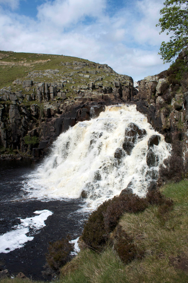
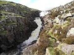
Unfortunately the walk begins with a two and a quarter mile stretch of road walking. However you can walk on the verge for most of the time, the roads are very quiet, there are good views of Teesdale and you are walking downhill ! Walk back down the reservoir access road and when you reach the Langdon Beck to Harwood road turn right (towards the hotel). Continue for almost a mile and just after passing a white painted barn, go over the cattle grid and turn right at the track to Windy Bank Farm at a Moor House, Upper Teesdale Nature reserve sign. Follow the winding track to the white painted Moor House farm and pass through the farmyard. Continue on the track on soft grassland, with the River Tees on your left and the dominant rock face of Cronkley Scar beyond. At a corner steep slopes close in on your right and the path is forced along a narrow route between the river and the slope. There is a short stretch of boulders to scramble over and then a short break before reaching the impressive Whin Sill outcrops of Falcon Clints on your right where there are more rocks along the path. Soon you hear the sound of Cauldron Snout. Where the Tees and Maize Beck meet the waterfall comes into sight.
There is now a scramble up the rocks at the side of the waterfall. Go carefully ! Cauldron Snout is more a series of steps that the water cascades down than a simple drop, and it is made that much more impressive by the fact that you are so close to the water, but if you find the route too challenging you can climb up the heather covered bank – there are faint tracks showing the routes that others have taken. At the top of the fall(s) continue up to meet the Birkdale Farm access road. Here the Pennine Way turns left, but your route continues straight up the right hand side of the dam. Continue ahead until you reach a gate. Go through and turn left on the stony track. After a couple of hundred yards, fork off to the right on a more minor but obvious track until you reach the road Here turn left to return to the car park.