THE TEES'POT WALKS
The Tees'pot Walk 1 : Hudeshope Beck & Aukside

|
|
Distance - 2.5 miles
Map : OS Explorer OL31 Parking : Middleton Sports' and Social Club |
|
|
|
Save the file to your device and then rename it by taking out the .txt at its end. Your device will now open it as a gpx file
|
| ||
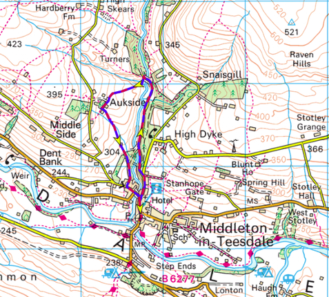
LANDRANGER 92 O/S Crown copyright 2016 CS-30288-W3Z2M1
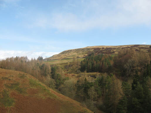
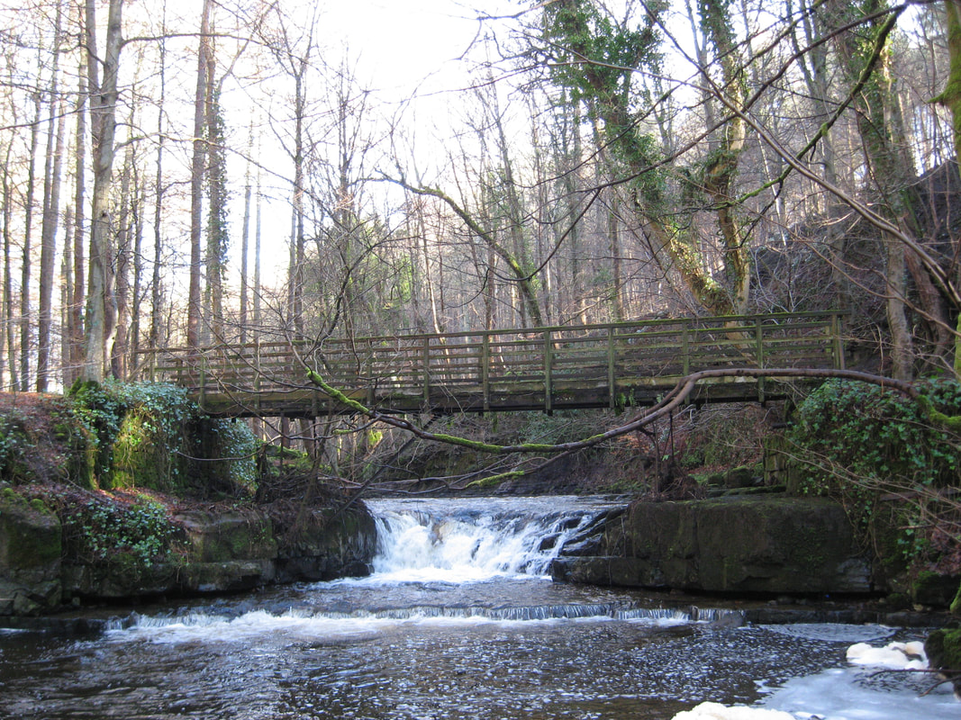
Leaving the cafe turn left up Bridge St. and left again at the main road. Almost immediately after the Teesdale Hotel take the road that turns off to the right signposted ‘Stanhope’. This road leads you past the Victorian parish church of St Mary’s and rises steeply up Town Head, but you leave it fairly soon by taking the road with a no through road sign that runs off to the left (Beck Road). The road leads into the attractive Hudeshope Woods and quickly drops down to Hudeshope Beck. As you walk you pass several small waterfalls and a picnic area. Continue along the road to cross the Miners’ Bridge. In a few yards you’ll see a gate on your left with two waymarks on it. Go through the gate and follow the arrow to the left. This crosses a small stream (be careful, after heavy rain it can be very fast flowing and quite wide) and rises up to a fence. Keeping the fence on your left follow tit uphill. When it joins a wall keep the wall on your left for a short distance to a stile. Go over the stile and cross the field diagonally roughly towards the junction of two walls to find another stone stile. Cross it and follow the wall on your left to a stile that leads out onto a Lane. Turn down the access lane and follow it past a barn and a disused house until arrive at Aukside Villa on your left. Immediately past the villa go through the gate on your left and then another gate a few yards on. Angle slowly to the right across the field to reach, in about 200 yards, a stone slab ‘bridge’ over a stream and go through the stile just beyond it. Turn left and go through two more fields, passing an old cottage and barn on your left and arriving at a wooden gate into the woods. Beyond this follow a path along side Throstle Gill, with a wall on your right.
You will reach a wider track in the woods. Here turn right and continue passing a few houses on your right and descending steps to reach the street. Now simply turn left and follow this road down to Alston Road, where you turn left again to return to the centre of Middleton
You will reach a wider track in the woods. Here turn right and continue passing a few houses on your right and descending steps to reach the street. Now simply turn left and follow this road down to Alston Road, where you turn left again to return to the centre of Middleton